
Products
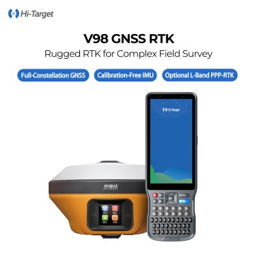
Hi‑Target V98 GNSS RTK Receiver, IMU Tilt Survey, Full‑Constellation GNSS, Built‑in 4G & Multi‑Protocol Radio
The Hi-Target V98 premium GNSS RTK receiver features advanced IMU tilt-compensated measurement technology and a powerful 660-channel full-constellation GNSS engine. Its user-friendly OLED touch screen ensures ease of operation, while built-in 4G connectivity and multi-protocol UHF radio enhance versatility for various surveying tasks. The rugged magnesium-alloy body, rated IP68 for water and dust resistance, guarantees durability in challenging environments. With an impressive operational time of up to 24 hours, the Hi-Target V98 is the ideal solution for cadastral, construction, topographic, and power transmission surveys, delivering reliable precision and efficiency.
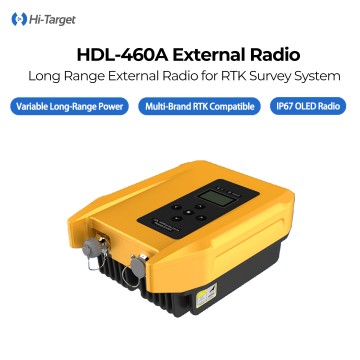
Hi-Target HDL-460A External UHF Radio Modem, 10W/35W Switchable Power, Up to 20km Transmission Range, Multi-Protocol Compatible for All Brands RTK Base & Rover Communication
The Hi-Target HDL-460A is a high-power external UHF radio modem specially customized for GNSS RTK base-rover differential data transmission. It supports switchable 10W / 35W transmitting power, delivering stable correction signal transmission up to 20km in open terrain. Adopting industrial-grade processing platform and full-protocol design, it seamlessly matches RTK receivers from Hi-Target, Trimble, South, CHC, Satel and other mainstream survey brands. Equipped with 1.3-inch HD OLED display, real-time voltage monitoring, 116 adjustable channels within 403–473MHz frequency band, IP67 dustproof & waterproof enclosure with 1.2m drop resistance, wide temperature adaptation from -30℃ to +65℃. It effectively solves signal attenuation and interruption issues for large-area engineering, topographic mapping, road & bridge layout, mining survey and long-distance construction stakeout projects, ensuring continuous stable RTK fixed positioning all day long.
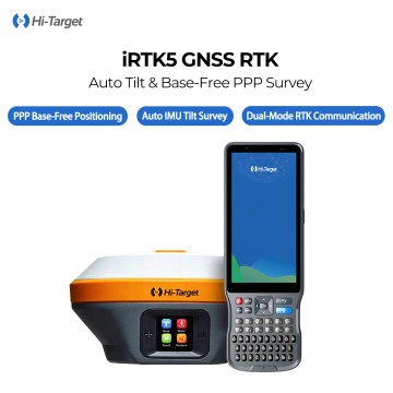
Hi Target IRTK5 GNSS RTK System Receiver GPS RTK DGPS Rover and Base with OLED Touch Screen
The Hi-Target iRTK5 is a compact, field-proven GNSS RTK system designed for precision and reliability. Featuring an IMU-based, calibration-free tilt survey and a multi-constellation high-precision engine, it delivers centimeter-level positioning accuracy consistently. The innovative Hi-RTP global PPP service and multi-protocol UHF radio enhance connectivity and performance. With its IP67-rated rugged housing, waterproof OLED touch screen, and durable long-life battery, the iRTK5 excels in surveying, construction layout, and geospatial fieldwork, even in challenging environments. Experience superior accuracy and robustness with the Hi-Target iRTK5 for all your positioning needs.
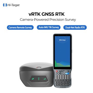
1408 Channels IMU Dual Camera 3D Modelling GNSS RTK Base and Rover Visual Survey Hi-Target VRTK Land Surveying Equipment
The vRTK GNSS RTK System is a cutting-edge, vision-aided positioning tool designed for high-precision surveying. This advanced system integrates binocular vision technology with nine-axis inertial navigation and a multi-constellation GNSS positioning algorithm. It effectively addresses positioning inaccuracies that often occur due to satellite signal blockage in challenging environments such as urban canyons, dense forests, and crowded building areas, With its capability for efficient tilt stakeout, the vRTK enhances intuitive visual real-time scene matching and point observation. This not only boosts the continuity of positioning but also significantly elevates measurement efficiency and operational ease. Ideal for applications such as field mapping, construction layout, and deformation monitoring, the vRTK GNSS RTK System is the perfect solution for professionals seeking reliable and accurate positioning in complex environments.
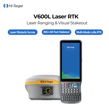
Hi-target V600L GPS RTK with 1408 Channels and IMU Suitable with Visual Laser and Real-Scene CAD Stakeout
The Hi-Target V600L is an advanced lightweight laser integrated RTK solution integrating 1408-channel multi-constellation GNSS, automotive-grade IMU, dual HD cameras and visible laser rangefinder. It breaks the limit of traditional pole contact measurement, realizing 2cm-precision non-contact survey within 10 meters for under-bridge, ditch, fenced and GNSS-shielded areas. Featuring auto-initialization inertial tilt measurement, ultra-light 730g body, built-in long-distance LoRa radio and all-day battery life with IP68 rugged protection, it greatly improves field safety & efficiency for complex terrain stakeout and topographic survey.
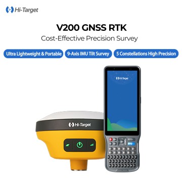
HI TARGET V200 Gnss Rtk 1408 Channels IMU 60° Tilt Survey Instrument Gps Gnss Receiver Rtk Permanent Code Without Failure
The Hi-Target V200 is a compact, lightweight high-precision GNSS RTK receiver engineered for efficient field surveying and stakeout work. Equipped with advanced 9-axis inertial navigation module, it supports wide-angle tilt measurement to simplify operation at blocked and hard-to-reach points. Adopting a 1408-channel full-band GNSS motherboard, it tracks multiple satellite constellations simultaneously with outstanding anti-interference and anti-occlusion performance to deliver steady centimeter-level positioning results in complex surroundings. Featuring a mini-sized lightweight body with IP68 rugged protection, integrated internal radio and built-in 4G communication, this RTK realizes flexible working modes, reduces long-time carrying fatigue, and reliably adapts to various harsh outdoor construction, mapping and deformation monitoring scenarios.
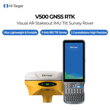
Hi Target V300 V500 Surveying Instrument Equipment Base and Rover Y Topografia Drones 350 400 Machine Gnss Rtk Gps Receiver
The Hi-Target V500 is a new-generation visual intelligent GNSS RTK receiver built for high-efficiency field survey and stakeout. Equipped with upgraded starlight wide-angle HD camera, it realizes AR real-scene overlay stakeout, directly superimposing design drawings on live view for quick point location. Integrated high-stability IMU module supports automatic initialization tilt survey, allowing measurement with inclined survey poles. Adopting 1408-channel full-constellation GNSS SoC chip, it tracks BDS-3 new frequencies plus GPS/GLONASS/Galileo/QZSS signals, delivering fast fixed solution and centimeter precision under tree canopy and urban canyon shielding. Compact lightweight body, IP68 waterproof & dustproof, 24-hour ultra-long battery life, multi-mode data transmission and professional Hi-Survey survey software. Widely applied in topographic survey, road & bridge layout, cadastral mapping, engineering lofting and land consolidation projects.

COMNAV T300 RTKRTK GPS GNSSGPS RTK HIGH PRECISION SURVEY EQUIPMENT GNSS
The COMNAV T300 RTK is the 1 high-performance, high-precision real-time dynamic differential positioning (RTK) device. The following is a detailed evaluation of the equipment:

COMNAV T100 RTKRTK GPS GNSSGPS RTK HIGH PRECISION SURVEY EQUIPMENT GNSS
The COMNAV T100 RTK is the 1 high-performance real-time dynamic differential positioning (RTK) device that integrates high-precision positioning, easy operation and durability. The following is a detailed evaluation of the equipment:

COMNAV T80 Laser Dual-Camera RTKRTK GPS GNSSGPS RTK HIGH PRECISION SURVEY EQUIPMENT GNSS
The parameters of the COMNAV T80 RTK are as follows:
basic parameters
Model: T80
Type: Flagship GNSS Receiver
Integrated technologies: GNSS, IMU, laser, vision technology
laser measurement parameters
laser modules: laser 3.0 modules
Maximum measuring radius: 50 m
Laser intersection measurement accuracy: up to 3cm at a distance of 20 meters

COMNAV T60 RTKRTK GPS GNSSGPS RTK HIGH PRECISION SURVEY EQUIPMENT GNSS
The COMNAV T60 RTK is the 1 high-performance real-time dynamic differential positioning (RTK) device that integrates advanced technology and innovative features. The following is a detailed evaluation of the equipment:
high precision positioning and high performance
COMNAV T60 RTK supports full-frequency signal reception of multi-satellite systems (such as GPS, GLONASS, BDS, Galileo, etc.), with up to 1590 channels and more than 50 available satellites. These 1 configurations ensure that the equipment can obtain stable and high-quality satellite signals in various environments, thereby achieving high-precision positioning. Its positioning accuracy can reach the centimeter level, and even under certain conditions, such as the use of laser modules, the positioning accuracy of the millimeter level can be achieved. In addition, T60 RTK also uses a new star-based enhancement algorithm and RTK and star-based fusion algorithm, which makes the star-based convergence more rapid and further improves the efficiency and accuracy of positioning.

COMNAV T30 RTKRTK GPS GNSSGPS RTK HIGH PRECISION SURVEY EQUIPMENT GNSS
The COMNAV T60 RTK is the 1 high-performance real-time dynamic differential positioning (RTK) device that integrates advanced technology and innovative features. The following is a detailed evaluation of the equipment:
high precision positioning and high performance
COMNAV T60 RTK supports full-frequency signal reception of multi-satellite systems (such as GPS, GLONASS, BDS, Galileo, etc.), with up to 1590 channels and more than 50 available satellites. These 1 configurations ensure that the equipment can obtain stable and high-quality satellite signals in various environments, thereby achieving high-precision positioning. Its positioning accuracy can reach the centimeter level, and even under certain conditions, such as the use of laser modules, the positioning accuracy of the millimeter level can be achieved. In addition, T60 RTK also uses a new star-based enhancement algorithm and RTK and star-based fusion algorithm, which makes the star-based convergence more rapid and further improves the efficiency and accuracy of positioning.

Stonex S6II / S990A GNSS RTK Receiver Cheap GPS Survey Instrument
The Stonex S990+ is a 1408-channel GNSS receiver that features characteristics that improve survey performance in the field.
The S990+ receiver is equipped with all major connectivity features, including Bluetooth, Wi-Fi, UHF radio, and a 4G modem. The internal 10,200mAh battery allows for up to 12 hours of operation and can be recharged via a USB Type-C connector.
Price: 100$

Stonex S9ii/s900 Gnss rtk System Stonex S9 Stonex S9ii Trimble 990 Mainboard Gps Rtk
Stonex S900+ è dotato di una scheda GNSS ad alte prestazioni da 1408 canali in grado di supportare più costellazioni satellitari: GPS, GLONASS, BEIDOU, GALILEO e QZSS.
Tramite il modem GSM 4G GSM, è garantita una connessione veloce per la ricezione dei dati di correzione così da raccogliere dati precisi e accurati.
Nella sua struttura straordinariamente compatta, i moduli Bluetooth e Wi-Fi consentono un flusso di dati al controller sempre affidabile, la Radio UHF TX/RX opzionale rende inoltre S900+ il perfetto sistema Base + Rover.
Il ricevitore S900+ è dotato della tecnologia IMU su richiesta.
Grazie al sensore inerziale potete misurare con la palina inclinata fino a 60°, focalizzando l’attenzione esclusivamente sul vostro rilievo. Questa innovazione è molto utile anche in fase di picchettamento.
Price: 100$

Foif a90 Gps Rtk Gnss Receiver Rtk Gps Gnss Surveying Base And Rover GNSS RTK
All-constellation, high performance
Full system BDS/GPS/GLONASS/Galileo/QZSS/SBAS, full-range RTK engine and Starry RTK technology
Fourth-generation inertial navigation tilt measurement technology
6-axis 400HZ dynamic output, no need to calibrate tilt measurement technology, point-to-point measurement
High-performance combination antennas
GNSS, Bluetooth, WIFI, 4G full network four-in-one antenna is highly integrated
All bands, all protocols, all compatible
Built-in transceiver integrated radio, support various transmission protocols
Intelligent dual-electric design
Detachable dual batteries, built-in power indicator, hot switching, the host will never stop powering
Price: 100$