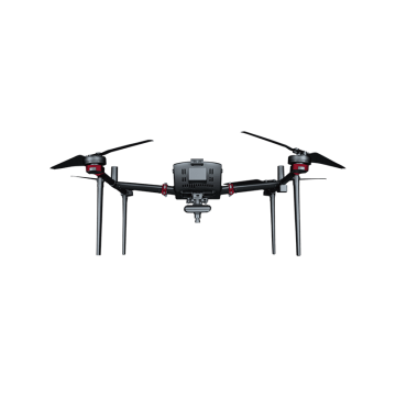
Photogrammetry Drone
At Chengdu Zhicun Space Surveying Instrument Co., Ltd., we are at the forefront of innovation in the field of photogrammetry drones. Our state-of-the-art drone technology is specifically designed to meet the evolving needs of land surveying and mapping. Combining cutting-edge Uav Drone Survey capabilities with high-precision GNSS integration, our drones empower professionals in various industries to gather accurate and reliable data quickly and efficiently. Whether you're in construction, agriculture, or environmental monitoring, our photogrammetry drones provide a game-changing solution that enhances the accuracy and speed of your projects, As global demand for advanced surveying solutions continues to rise, Chengdu Zhicun Space Surveying Instrument Co., Ltd. stands ready to support your goals with our versatile and reliable Drone Land Surveying equipment. Our commitment to quality and innovation ensures that our products not only meet but exceed industry standards, allowing you to generate detailed 3D models and precise topographic maps like never before. Partner with us to experience the future of surveying; with our Gnss Drones, you can capture the landscape with unprecedented detail and transform the way you approach your surveying tasks. Join the growing number of industry leaders who trust our photogrammetry drone technology to elevate their operations and achieve remarkable results