





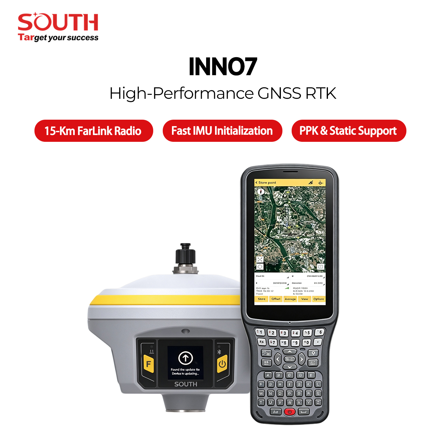
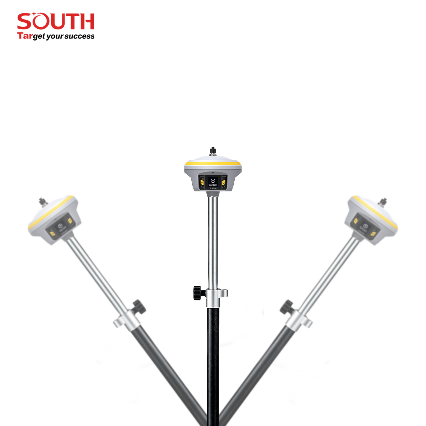
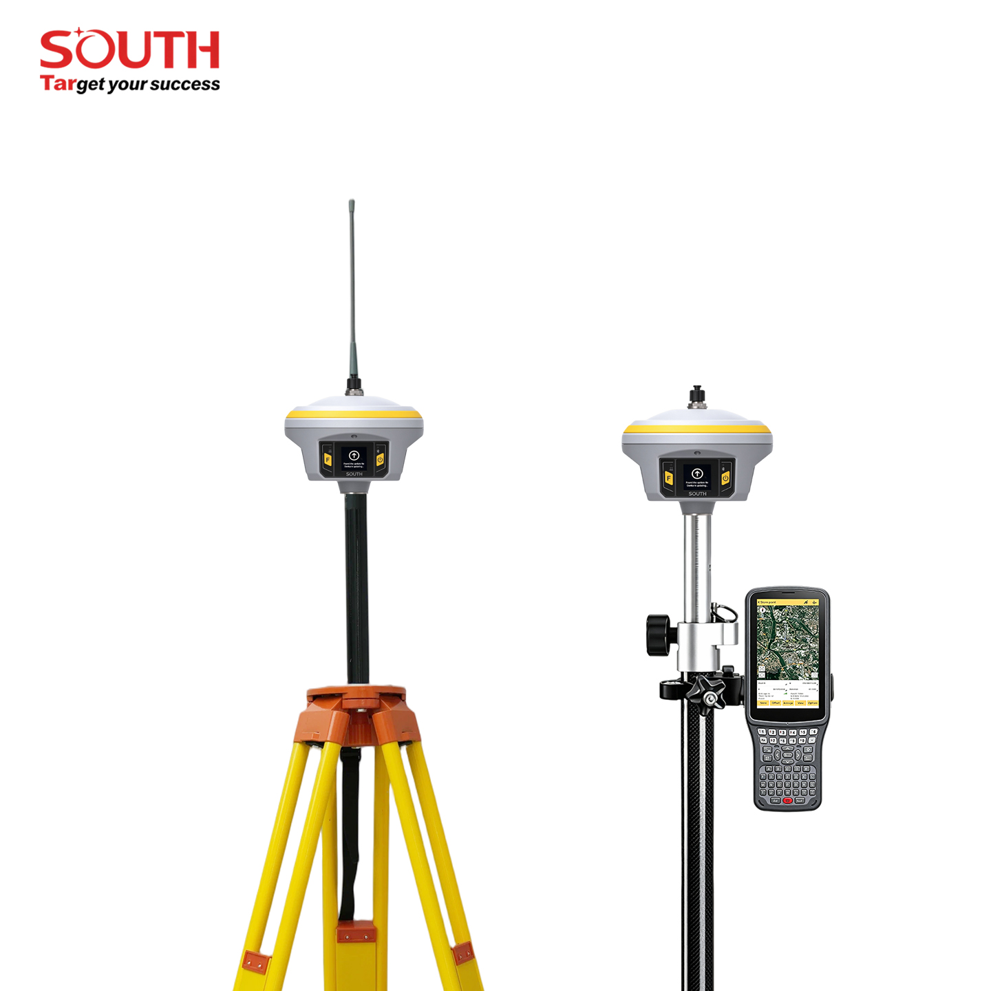
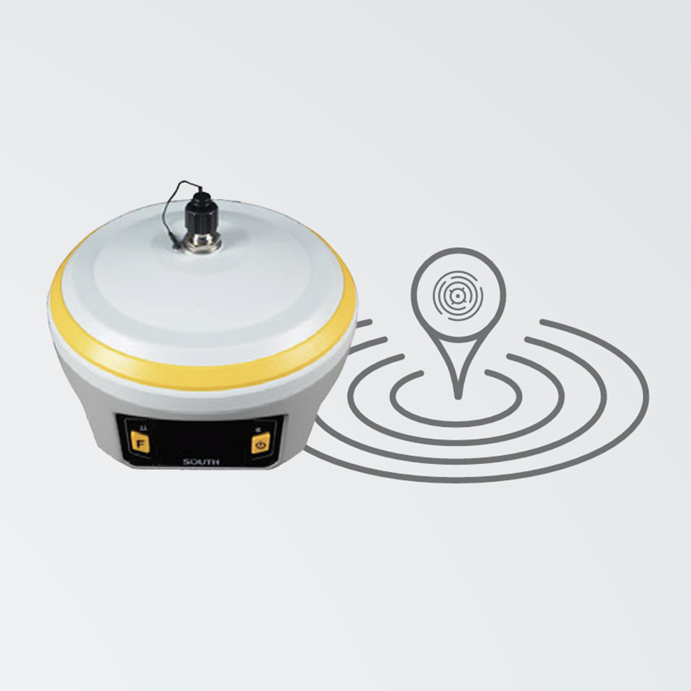
SOUTH INNO7 Dual-RTK GNSS Receiver with 15km Radio & 5G Ready
SOUTH INNO7 Smart Interactive RTK Receiver
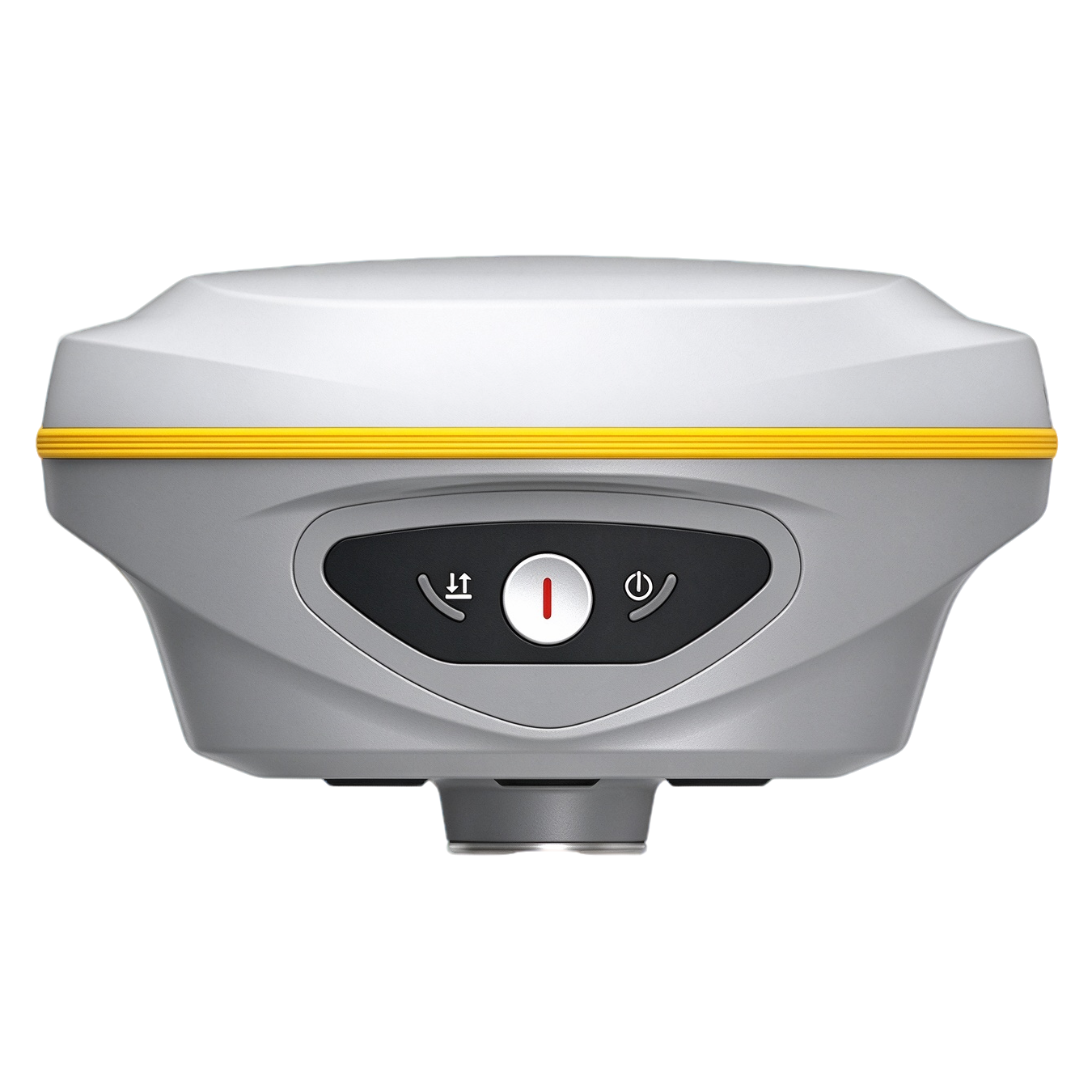
Dual‑RTK² engine algorithm, SLink global PPP service, RTK XTRa xFill technology, 15‑km FarLink radio, 1.54‑inch touch OLED, 64GB SSD large storage, new‑generation anti‑magnetic‑interference IMU for full‑scenario surveying‑mapping projects.
Core Competitive Highlights
Smart interactive RTK reshaping modern field‑survey workflow
Dual‑RTK² Engine Algorithm
Innovative dual‑RTK engine performs secondary coordinate verification and calculation. Effectively eliminate false‑fix coordinates, improve positioning stability and field‑operation reliability under complex multi‑path environments.
SLink PPP & RTK XTRa xFill Technology
SLink global PPP service achieves centimeter‑level positioning without local base‑station. RTK XTRa extends RTK fix for several minutes when differential correction stream is interrupted, ensure continuous measurement.
15‑KM FarLink 3W UHF Radio
Max 3W transmitting‑power FarLink protocol radio, typical open‑sky working‑range reaches 15km. Larger transmission bandwidth for multi‑constellation raw‑data, reduce power consumption greatly compared with traditional radio solutions.
Touch‑OLED & 64GB SSD + Anti‑Magnetic‑Interference IMU
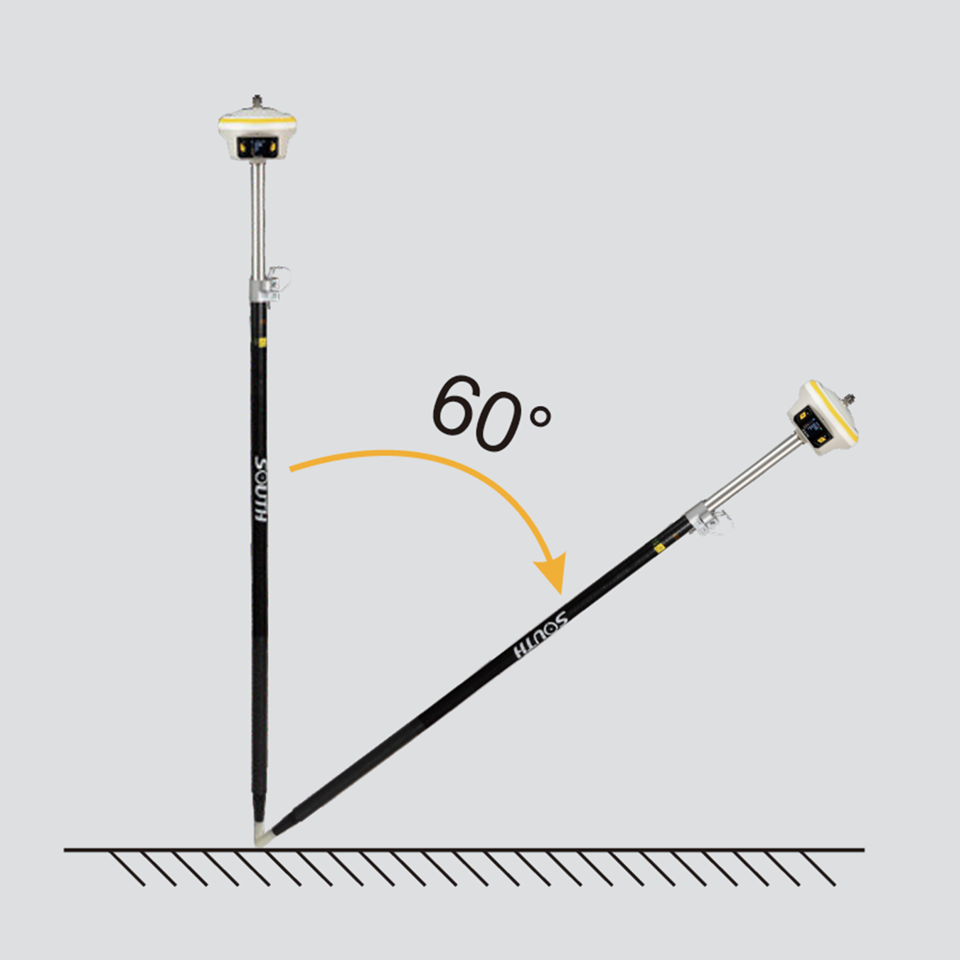
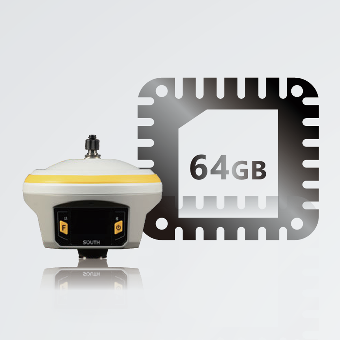
1.54‑inch high‑brightness touch‑OLED for direct receiver‑side configuration. 64GB cyclic‑storage SSD. New‑gen IMU anti‑magnetic‑interference, max 60° tilt compensation, only 2‑5‑seconds initialization.
Key Functional Highlights
Breakthrough functions for complex survey environments
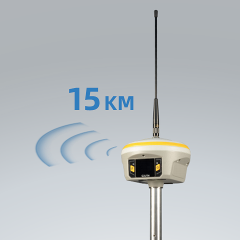
15KM FarLink 3W UHF Radio
INNO7 adopts an internal radio with 3W maximum transmission power to achieve the typical working range as 15km through “Far-link” protocol. The transmission bandwidth becomes large, which perfectly solves the problem of large data volume of multiple constellations transmission. And the power consumption can reduce about 60% in the same amount of data transmission compare to the traditional RTK.
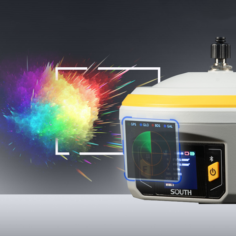
Touch Screen Interaction
HD 1.54 inch color LCD touch screen with high brightness and low power consumption is more suitable for field work, which is convenient and efficient to complete touch settings, information browsing, function settings.
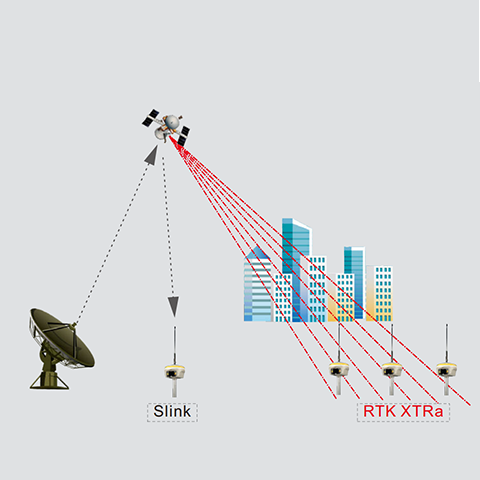
Slink & RTK XTRa
SLink global PPP service delivers centimeter‑level positioning without local base‑station. RTK XTRa xFill technology sustains RTK fix for several‑minutes once differential‑stream breaks, avoid work‑interruption caused by radio‑signal loss.
Best Hardware — To Win the Challenges
SurvStar APP
Measure & Draw : Save Time in Field work and Office
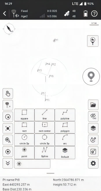
This feature allows you to draw the result map while completing point measurements. Before measuring points, users can choose the shape of the target object to be measured from 11 preset figures. The software will guide you to measure points in order and automatically connect lines and complete the drawing of the figure.
Visual Positioning : Industry-Leading Non-Contact Measurement Technology
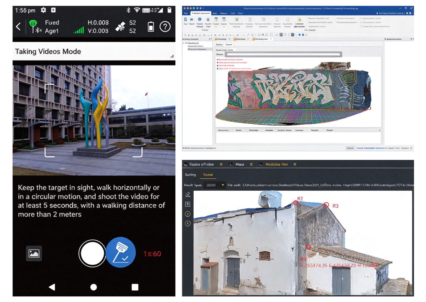
Photogrammetry Measurements can be conducted by taking pictures or videos. Coordinates of all points in the photos can be acquired. Now, target points that are inaccessible due to dangerous environments, poor satellite signals, or impossible terrain can be measured remotely.
CAD Draw : Drafting without a PC
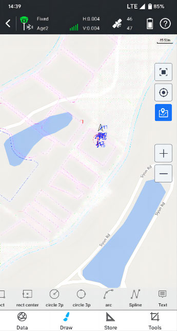
Select points to form a polygon, and directly identify the area division points for the surveyor to stake out. There is no more need for the user to guess a position to measure, and then to adjust. CAD drawing does not require a computer.
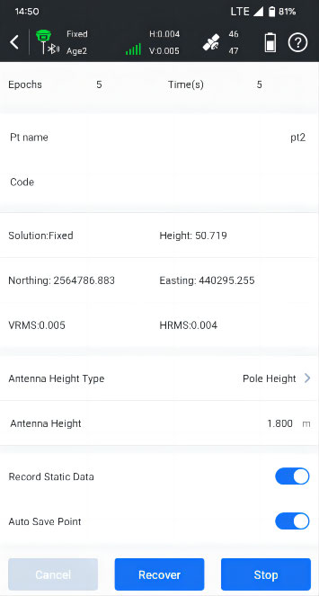
Static & PPK Measurement : More Assistance Now is Available
The software provides both static and PPK data collection capabilities. Data can be downloaded wirelessly, no need for a PC and cables. It is possible to convert .sth files into RINEX files right on the data collector or tablet or your phone, no need of PC.
CAD Stake-Out : Save Labor Cost and Reduce Errors
Traditional data collection software requires users to import points or lines to be setout from .csv or .txt files, users need to spend quite a lot of time to edit point and line libraries. Moreover, for complex shapes such as curves, circles, and polygons, the traditional stake-out process is complicated.
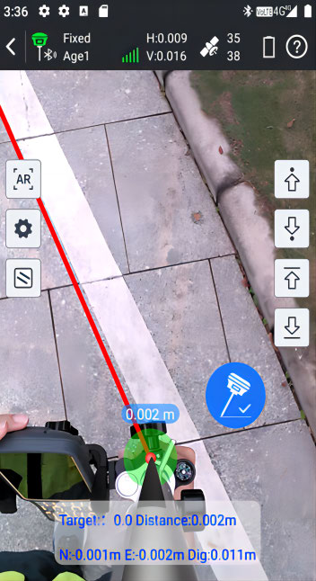
Live-View Stake-Out : Faster, More Accurate, More Intelligent
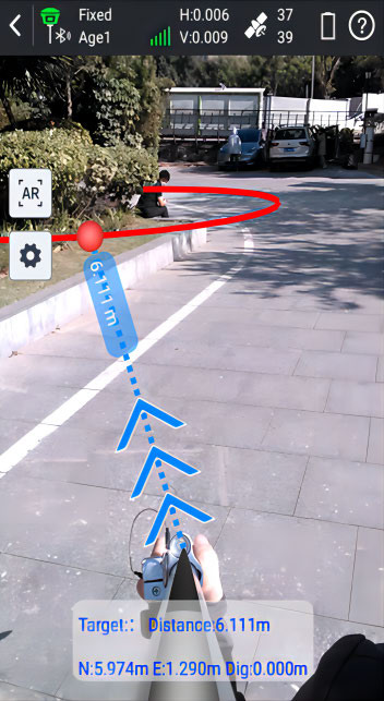
Users utilize the real-time image captured by the camera at the bottom of the receiver and the AR guide lines displayed by the software, to locate the target points. When users perform stake-out with a dual-camera GNSS receiver, the software can call upon both cameras to work together.
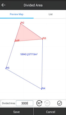
Area Division : Developed for Professional Cadastral Survey and Stake Out
Select points to form a polygon, and directly identify the area division points for the surveyor to stake out. There is no more need for the user to guess a position to measure, and then to adjust. Six methods of division to determine the area division points.
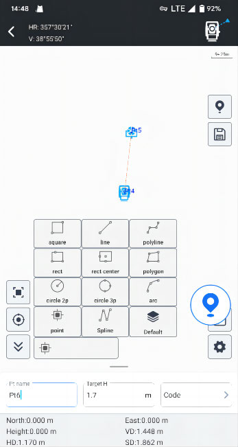
Additional Features & Innovations for Better User Experience
Compatible with Multiple Devices. RTK Data Backup, QR Code Share, Multiple Basemap Support, Basemap Adjustment, Network Mount Point Sorting, NMEA Output Setting... The App now works with GNSS, Total Station, Echo Sounder, GIS Tablet, in future it will work with SLAM Scanner, Terrestrial LiDAR Scanner.
SOUTH Geo Office (SGO)
Ideal GNSS Data Processor, Help You To Keep Advancing
Data Processing & Reporting
When surveyors need to do post-processing of GNSS data, our software always can provide state-of-the-art technology to help you to produce optimal results. User just need to import field data, the software will automatically process GNSS baselines. Once results come out, the software can generate reports.
RINEX Import and Export
This feature enables users to import the third party GNSS receiver data into our software and post-process it, by using the industry standard RINEX format.
High Accuracy Guaranteed
RTK check, the unique function in our software, can compare RTK and PPK results to automatically acquire the most accurate coordinates for each target point. It fills up the gap of poor corrections in RTK or hindered observations in PPK.
3D Modelling
User can import photogrammetry image data into the software, to achieve 3D modeling, visually presenting geographic information data such as coordinates, areas, and volumes.
Technical Specifications
SOUTH INNO7 Smart Interactive GNSS RTK Receiver
| Item | Parameters |
| GNSS Channels | Multi‑constellation full‑band tracking |
| IMU Tilt Compensation | Anti‑magnetic‑interference IMU, max tilt angle 60°, initialization 2‑5s |
| Display Screen | 1.54‑inch HD touch‑OLED screen |
| Internal UHF Radio | FarLink, max 3W transmit‑power, 410‑470MHz, typical 15km open‑sky range |
| Storage | 64GB SSD, cyclic auto‑erase storage, support USB‑OTG external‑storage |
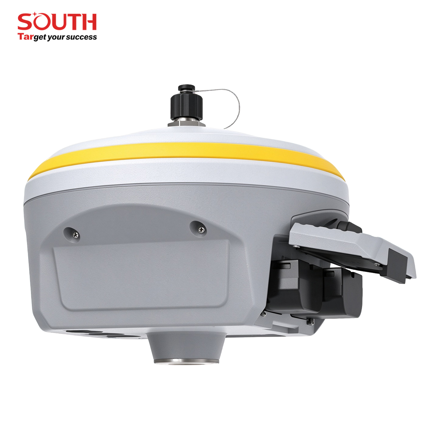
| Dimension / Weight | Φ153mm × H106mm, 1.2kg (with battery) |
| Material | Magnesium‑aluminum alloy housing |
| Protection Grade | IP68, withstand 2‑meter pole‑drop onto cement‑ground |
| Battery / Working Hour | Dual removable lithium‑ion batteries; rover‑mode up to12h, static‑mode up to16h |
Applications
Wide range of professional survey application scenarios




Frequently Asked Questions
Common questions about SOUTH INNO7 Smart Interactive RTK
Q: What is Dual‑RTK² dual‑engine algorithm?
A: Dual‑RTK² runs two independent positioning‑computation threads and performs secondary coordinate cross‑verification, effectively filter false‑fix coordinates caused by multi‑path signal reflection in complex urban‑building environments.
Q: Difference between SLink PPP and RTK XTRa xFill?
A: SLink PPP realizes centimeter‑level positioning without local base‑station. RTK XTRa xFill extends existing RTK fix duration when differential‑correction signal is temporarily lost, not for standalone positioning.
Q: What is anti‑magnetic‑interference IMU?
A: The IMU module suppresses magnetic‑field interference. It can work stably near steel‑structure, iron‑tower and magnetic‑disturbance‑sources, only requires 2‑5‑seconds shaking‑motion to finish initialization.
Q: Can I operate INNO7 directly without external controller?
A: Yes. Equipped with 1.54‑inch touch‑OLED screen, you can check receiver‑status, switch working‑modes and configure parameters on‑device; SurvStar controller is still required for field‑survey collection and stake‑out operations.




SPECIFICATIONS
| GNSS Features | |
|---|---|
| Channels | 336, 1598 (optional) |
| GPS | L1C/A, L1C, L2C, L2E, L5 |
| GLONASS | L1C/A, L1P, L2C/A, L2P, L3 |
| BDS | B1, B2, B3 |
| GALILEO | E1, E5A, E5B, E5AltBOC, E6 |
| SBAS | L1C/A, L5 (Just for the satellites supporting L5) |
| IRNSS | L5 |
| QZSS | L1C/A, L1 SAIF, L2C, L5, LEX |
| MSS L‑Band | Trimble RTX[1] |
| Positioning output rate | 1Hz‑50Hz |
| Initialization time | < 10s |
| Initialization reliability | >99.99% |
| Positioning Precision | |
| Code differential GNSS positioning | Horizontal: 0.25 m + 1 ppm RMS Vertical: 0.50 m + 1 ppm RMS |
| GNSS static | Horizontal: 2.5 mm + 0.5 ppm RMS Vertical: 5 mm + 1 ppm RMS |
| Real‑time kinematic (Baseline<30km) | Horizontal: 8 mm + 1 ppm RMS Vertical:15 mm + 1 ppm RMS |
| SLink (RTX)[2] | Horizontal:4‑10 cm Vertical:8‑20 cm |
| RTK XTra (xFill)[3] | Horizontal: 5 mm +10 ppm RMS Vertical: 5 +20 mm/min RMS |
| SBAS positioning | Typically<5m 3DRMS |
| RTK initialization time | 2‑8s |
| IMU tilt angle | 0°‑60° |
| Hardware Performance | |
| Dimension | 15.3cm(φ)×10.6cm(H) |
| Weight | 1.2kg (battery included) |
| Material | Magnesium aluminum alloy shell |
| Operating temperature | -25℃‑+65℃ |
| Storage temperature | -35℃‑+80℃ |
| Humidity | 100% Non‑condensing |
| Waterproof/Dustproof | IP68 standard, protected from long time immersion to depth of 1m IP68 standard, fully protected against blowing dust |
| Shock/Vibration | Withstand 2 meters pole drop onto the cement ground naturally |
| Power consumption | 3W |
| Power supply | 6‑28V DC, overvoltage protection |
| Battery | 7.4 V 3400mAh×2 rechargeable, removable Lithium‑ion battery |
| Battery life* | 16h (static mode) 10h (internal UHF base mode) 12h (rover mode) |
| Communications | |
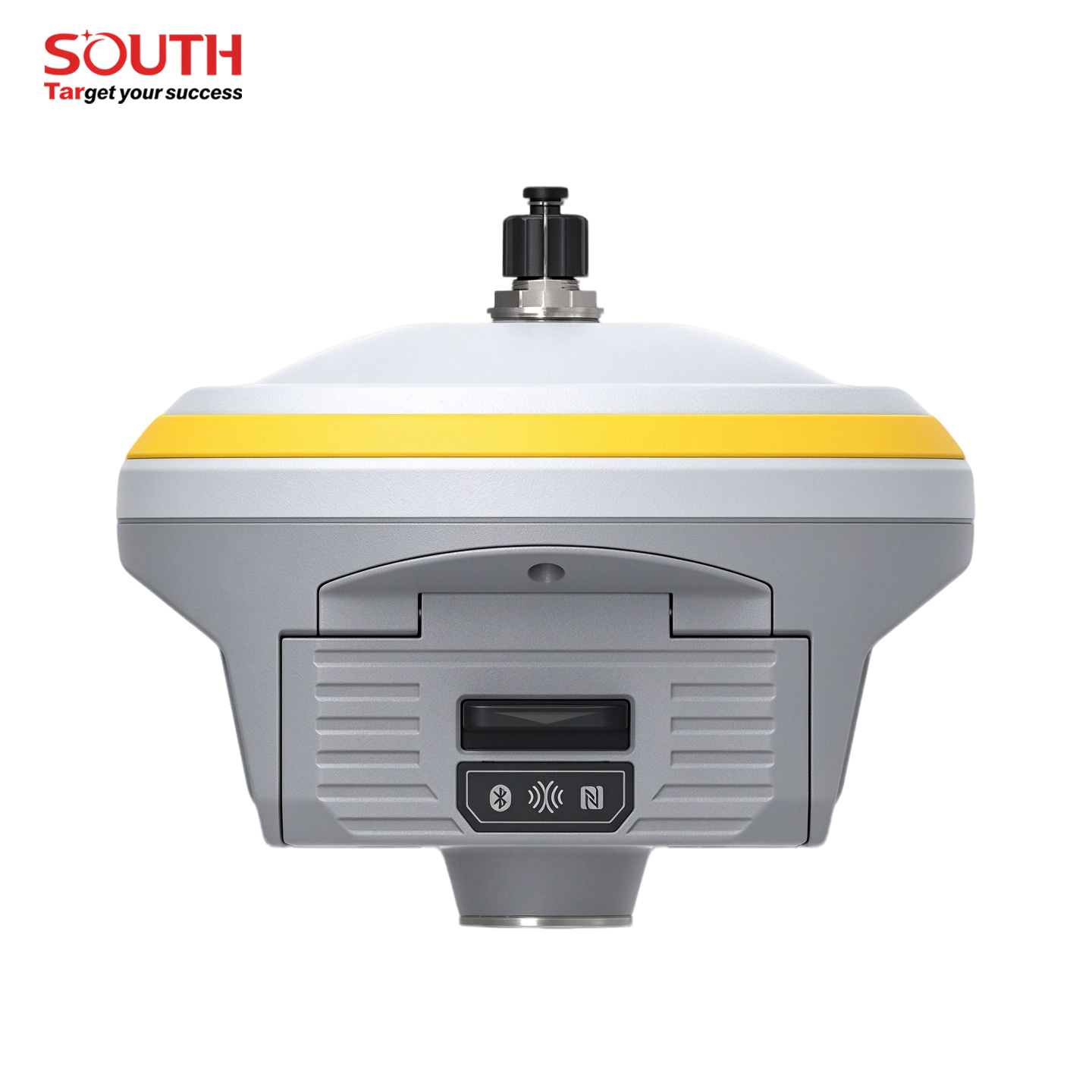
| I/O Port | 5PIN LEMO external power port + Rs232 7PIN LEMO +external USB(OTG)+Ethernet 1 UHF antenna interface 1 GNSS antenna interface (internal and external antenna switchable) SIM card slot (standard) |
| Internal UHF | Radio receive and transmit, 1W/2W/3W switchable, radio router and repeater |
| Frequency range | 410‑470MHz |
| Communication protocol | Farlink, Trimtalk450s, SOUTH, SOUTH+, SOUTHX, HUACE, Hi‑target, Satel |
| Communication range | Typically15km with Farlink protocol |
| Cellular mobile network | Advanced 5G network communication module, downward compatible with 4G/3G |
| Bluetooth | Bluetooth4.0 standard, Bluetooth2.1+EDR |
| NFC Communication | Realizing close range (shorter than10cm) automatic pair between receiver and controller(controller requires NFC wireless communication module else) |
| WIFI | |
| Modem | 802.11 b/g standard |
| WIFI hotspot | Receiver broadcasts its hotspot web UI accessing with any mobile terminals |
| WIFI datalink | Receiver can transmit and receive correction data stream via WiFi datalink |
| Data Storage/Transmission | |
| Storage | 64GB SSD internal storage Automatic cycle storage (The earliest data files will be removed automatically while the memory is not enough) Support external USB storage The customizable sample interval is up to 50Hz |
| Data transmission | Plug and play mode of USB data transmission Supports FTP/HTTP data download |
| Data format | Differential data format: CMR+, SCMRX, RTCM2.1, RTCM2.3, RTCM3.0, RTCM3.1, RTCM3.2 GPS output data format: NMEA0183, PJK plane coordinate, Binary code, Trimble GSIF Network model support: VRS, FKP, MAC, fully support NTRIP protocol |
| Sensors | |
| Electronic bubble | Controller software can display electronic bubble, checking leveling status of the carbon pole in real‑time |
| IMU | Built‑in IMU module, calibration‑free and immune to magnetic interference |
| Thermometer | Built‑in thermometer sensor, adopting intelligent temperature control technology, monitoring and adjusting the receiver temperature |
| User Interaction | |
| Operating system | Linux |
| Buttons | 2‑button and visual operation interface |
| Indicators | 2 LED indicators, data interaction indicator and Bluetooth indicator |
| LCD | 1.54‑inch HD color LCD touch screen with resolution 240*240 |
| Web interaction | With the access of the internal web interface management via WiFi or USB connection, users are able to monitor the receiver status and change the configurations freely |
| Voice guidance | The intelligent voice technology provides status and operation voice guidance, supports Chinese/English/Korean/Spanish/Portuguese/Russian/Turkish |
| Secondary development | Provides secondary development package, and opens the OpenSIC observation data format and interaction interface definition |
| Cloud service | The powerful cloud platform provides online services like remote manage, firmware update, online register and etc |